COCUMSCUSSOC:
An Evolving Landscape
Trail & Path Guide
With thanks to the Rhode Island Wild Plant Society (RIWPS)
Brochure and trail signage supported by:
The Jelm Educational Fund
Rhode Island Historical Preservation and Heritage Commission (CLG Grant)
2017
Landscape History
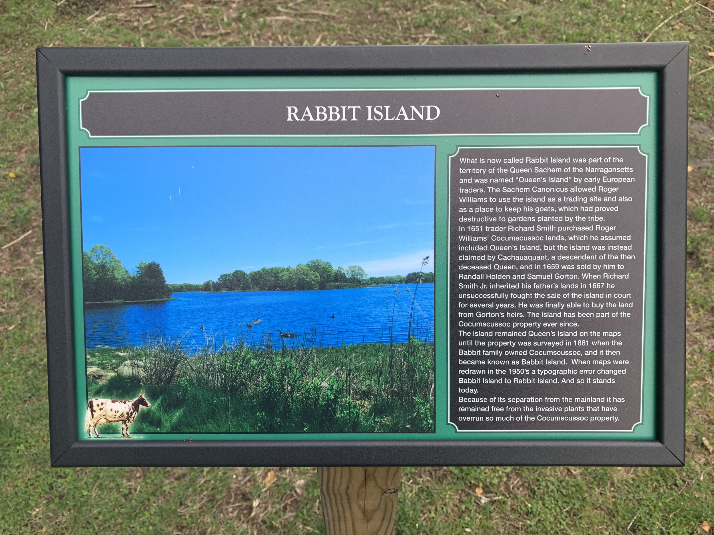
The Narragansett Bay shoreline, a Native American summer camp site for centuries before European settlement, was relatively free of heavy forest cover in 1651 when trader Richard Smith began to acquire large tracts of land that included today’s Cocumscussoc from Roger Williams and Narragansett sachems. The Native American practice of slow spring burns to facilitate hunting had eliminated woodland undergrowth, and Richard Smith saw this park-like landscape with its rich soils as an ideal location for farming and pasturage to support his settlement and to provide agricultural products for trade.
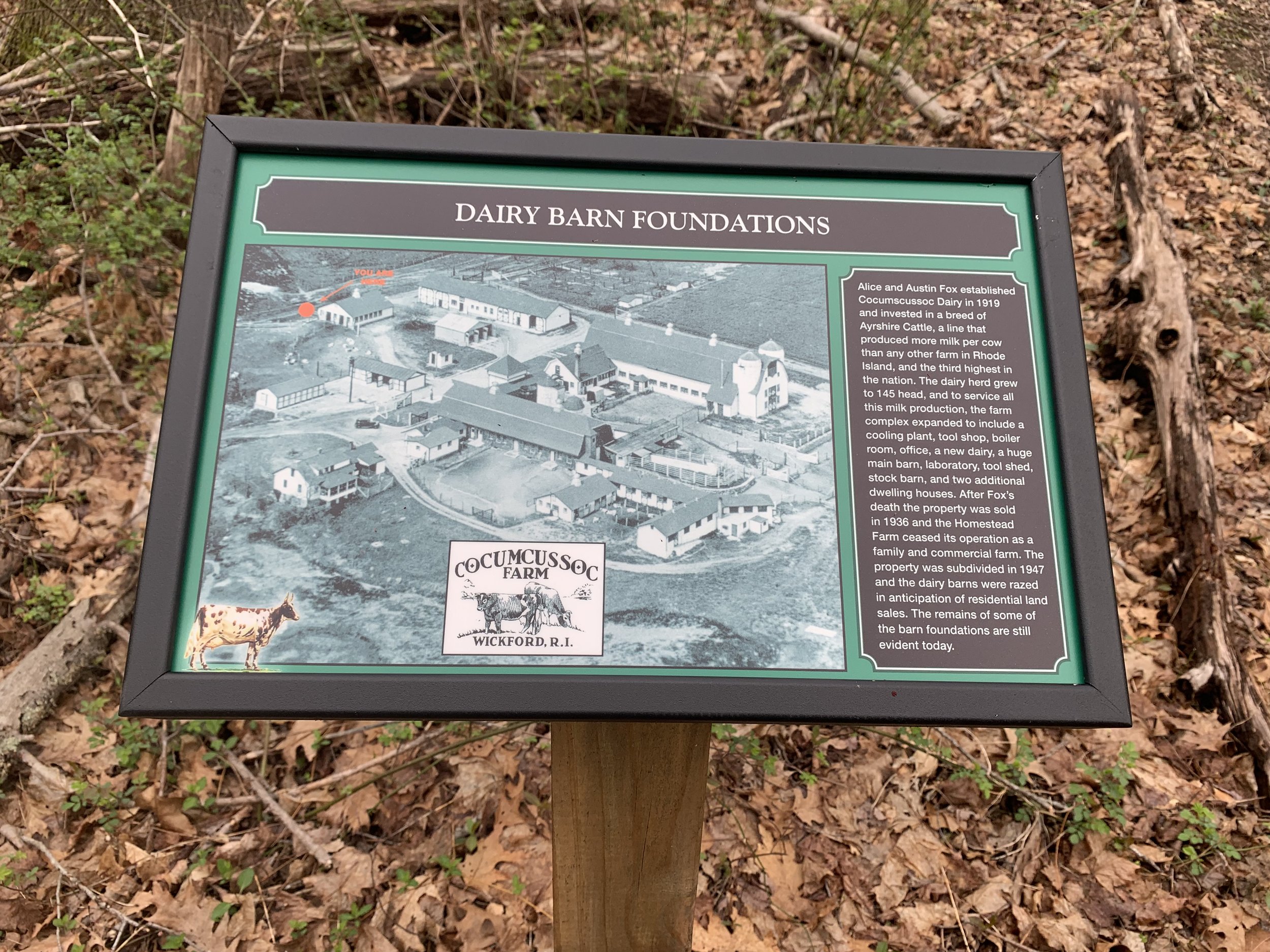
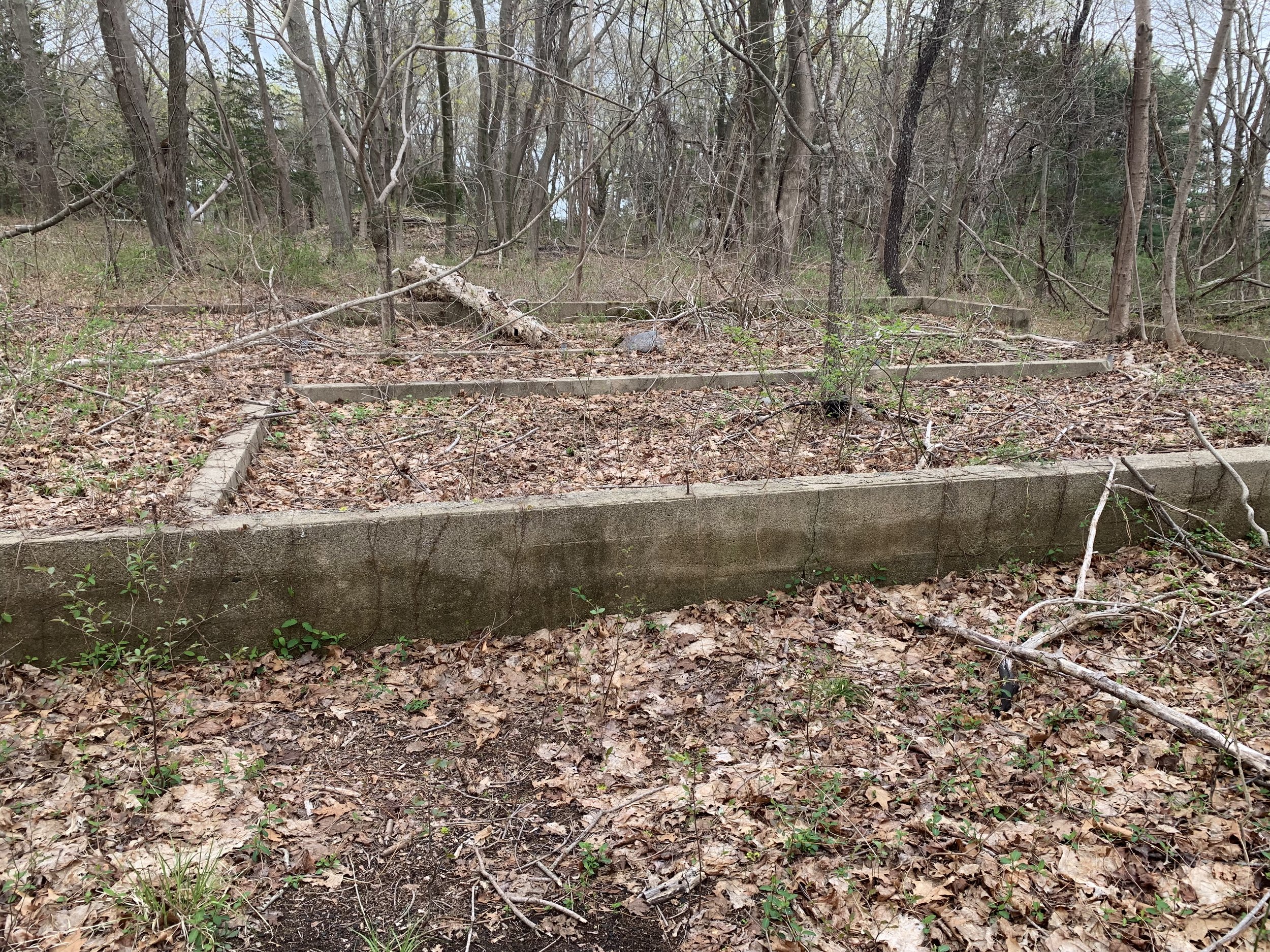
In the centuries that followed, Cocumscussoc was inhabited by generations of owners who manipulated the landscape to suit changing agricultural needs, and large swaths of farmland were broken up into smaller parcels. The last working farm on this site before the property was acquired by the Cocumscussoc Association in 1948 was owned by the Fox family, whose herd of prize-winning Ayrshire cattle supplied the North Kingstown area with dairy products and their famous ice cream.
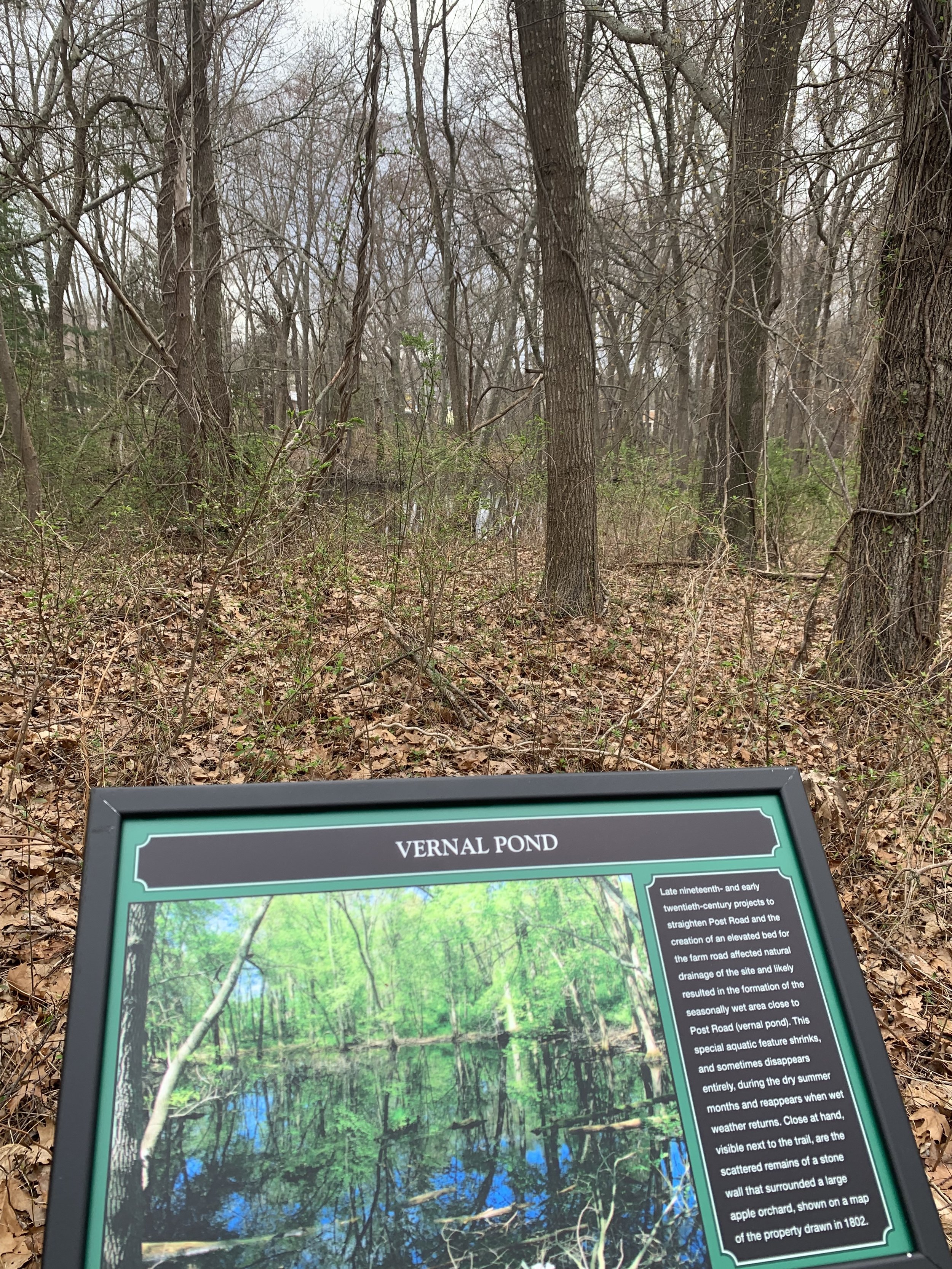
Husbandry practices were not the only agents of change. In the late 19th and early 20th centuries projects to straighten Post Road and the creation of the elevated roadway for the Sea View Railroad, which required the re-direction of Cocumscussoc Brook, dramatically altered both surface and groundwater flow patterns and left an indelible mark on the landscape. Seventy years ago Cocumscussoc was mostly open pastureland. The trees and dense undergrowth we see today bear witness to the fact that, left undisturbed, nature will take its course.
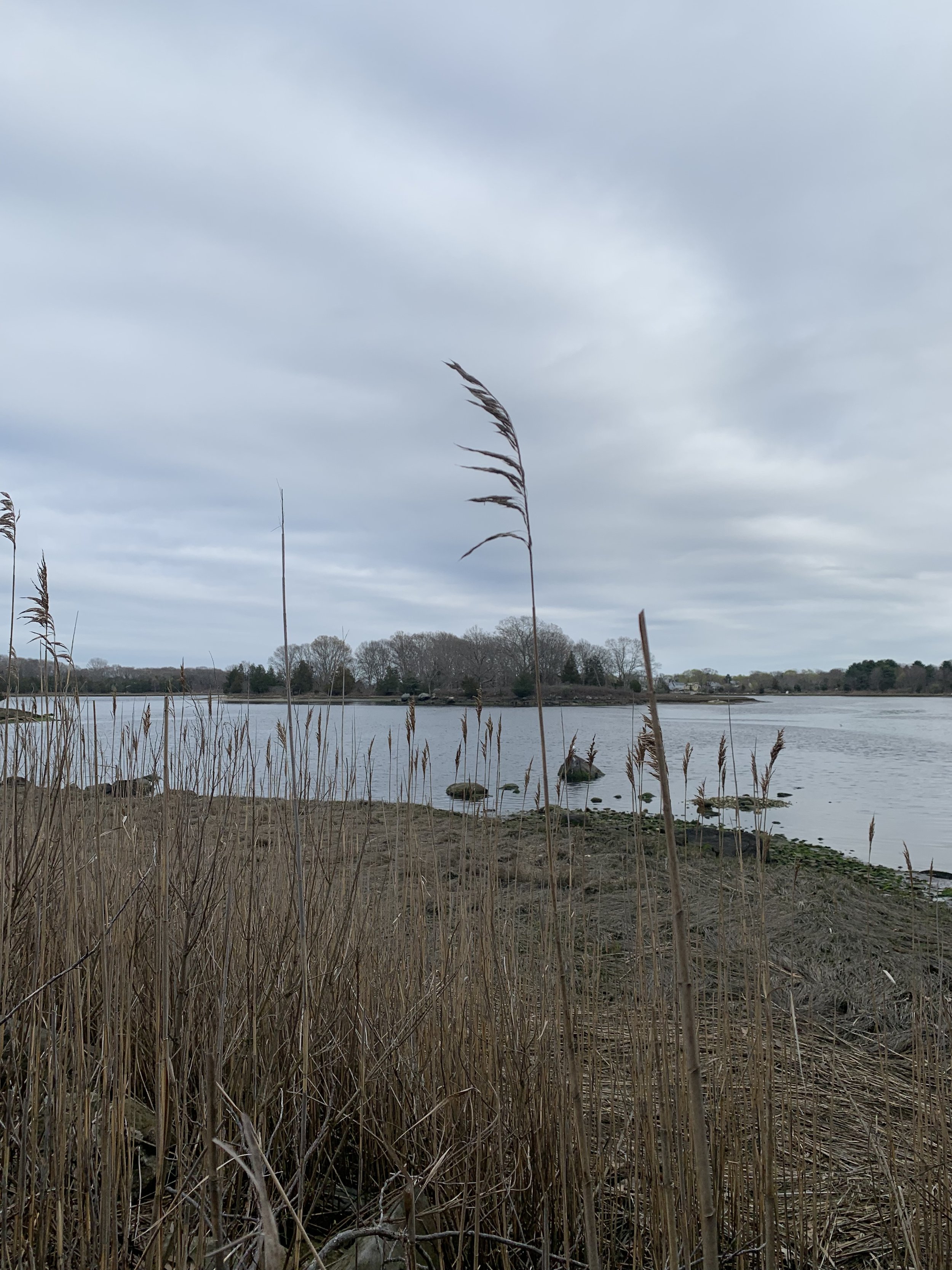
As you walk the trails, consider how changing climate will affect this landscape in the future. Certainly, sea level rise will alter the outlines and the very nature of the connections between the low-lying salt and freshwater resources that are integral to the greater Mill Cove coastal complex. What are some other possible changes? In confronting new challenges it is well to remember how valuable this site’s interspersed coves, salt marshes, swamps and upland forests are as a local eco-system.
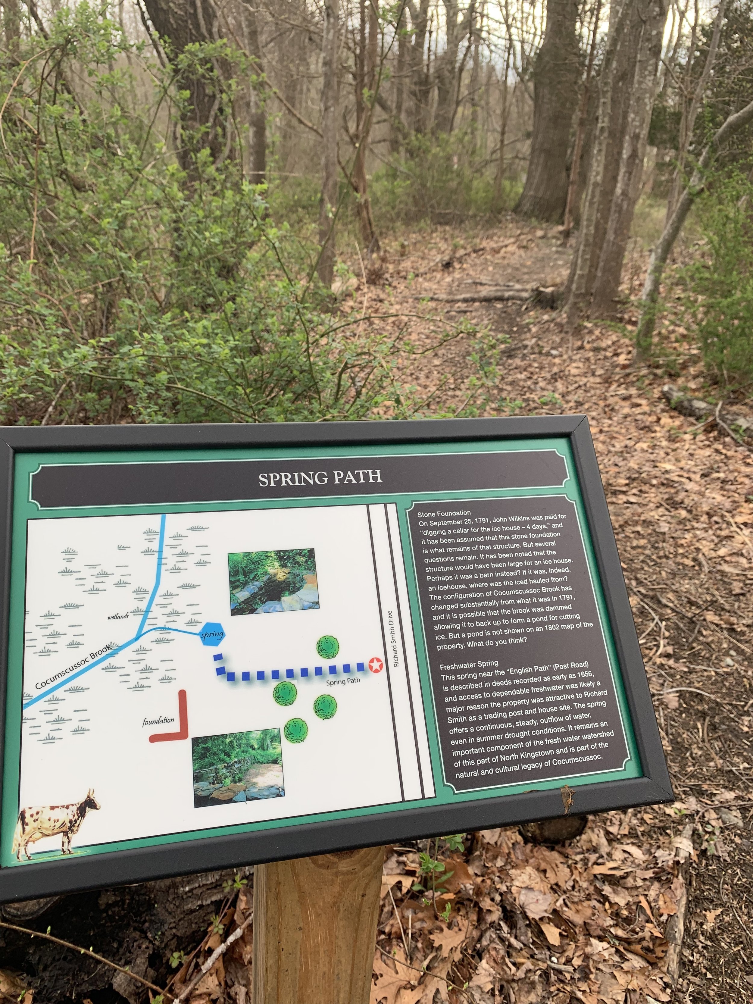
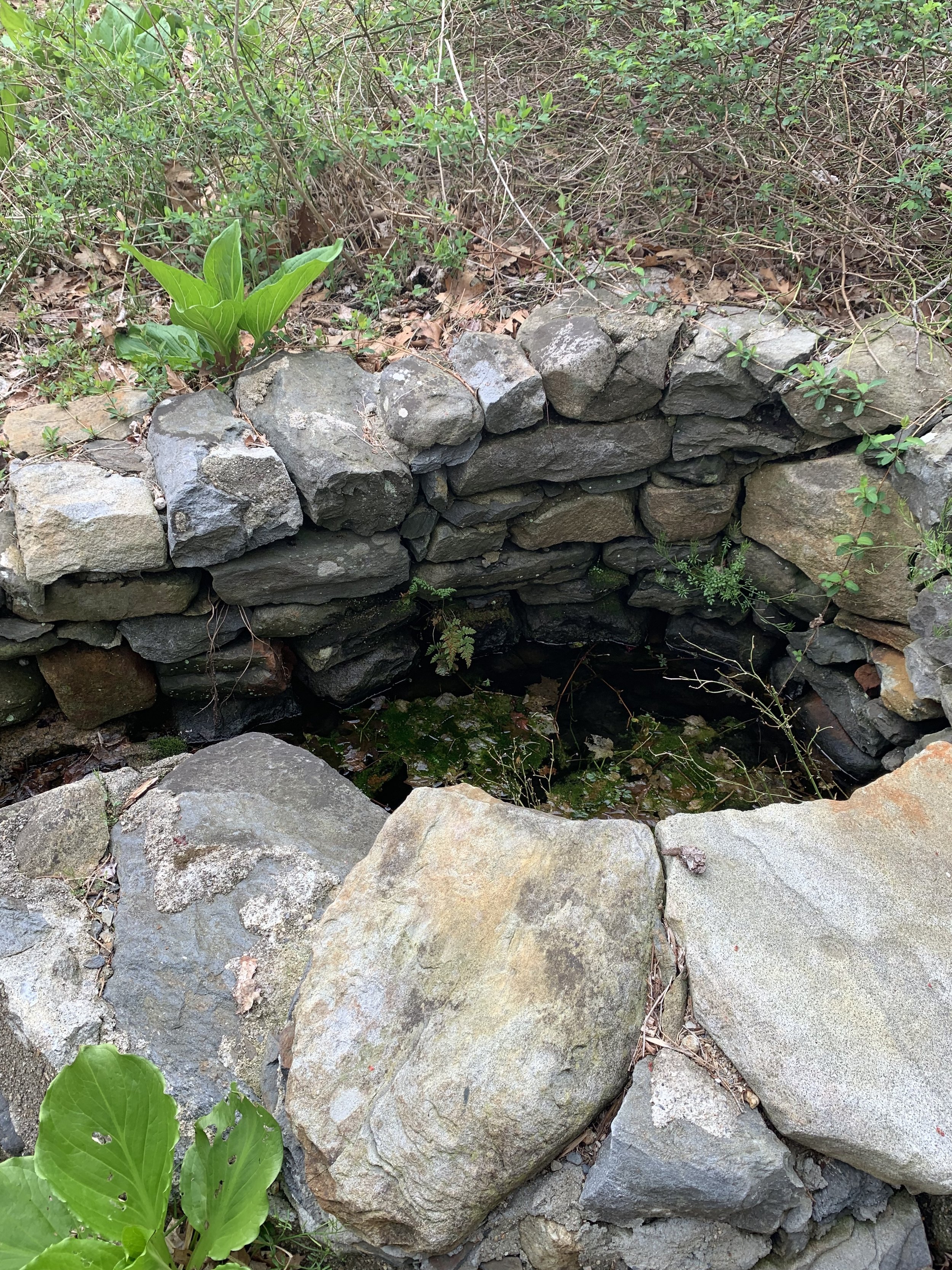
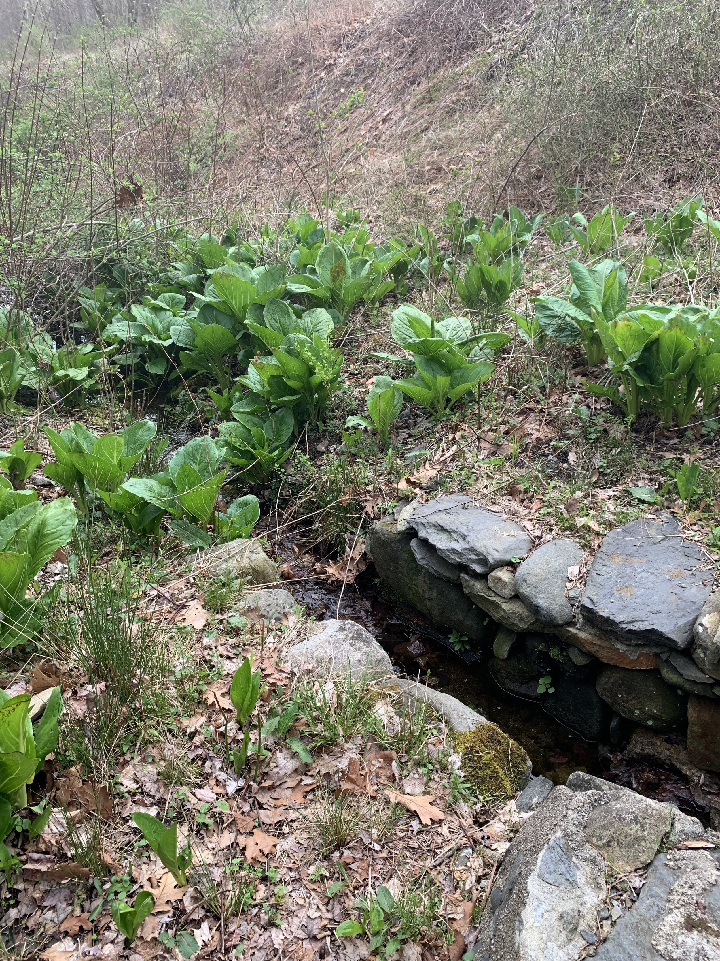
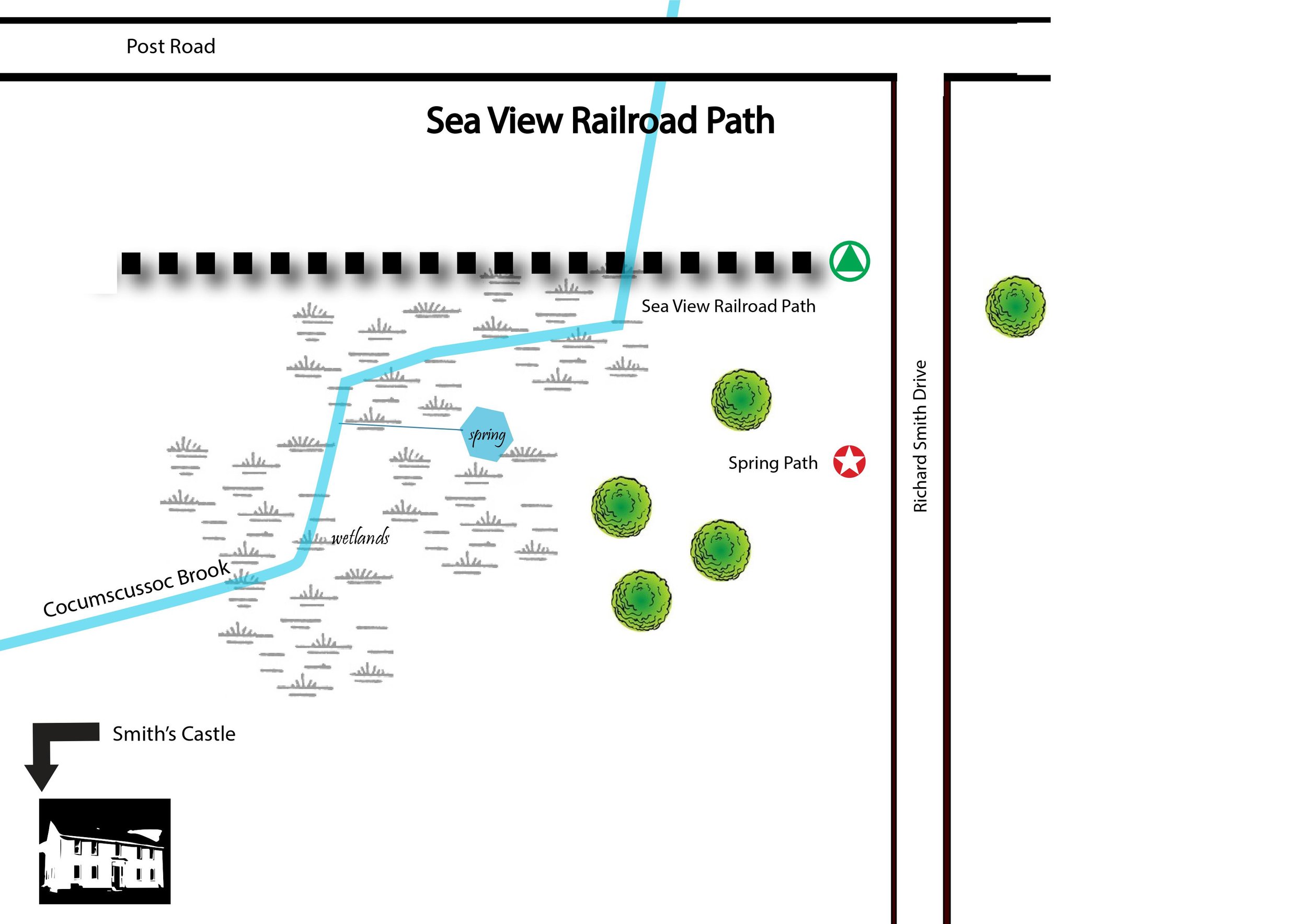
The Spring Path
The Spring was first described in a deed from 1659, and this source of dependable fresh water was likely one reason that Cocumscussoc was considered a desirable location for settlement.
The Stone Foundation is something of a mystery. It is known that an icehouse was built somewhere in this vicinity in 1791, but there are vague references to a barn as well. It has been noted that the foundation seems large for an ice house, and there are questions about the possible source for ice. Was Cocumscussoc Brook dammed? So far, available sources haven’t provided a definitive answer. What do you think?

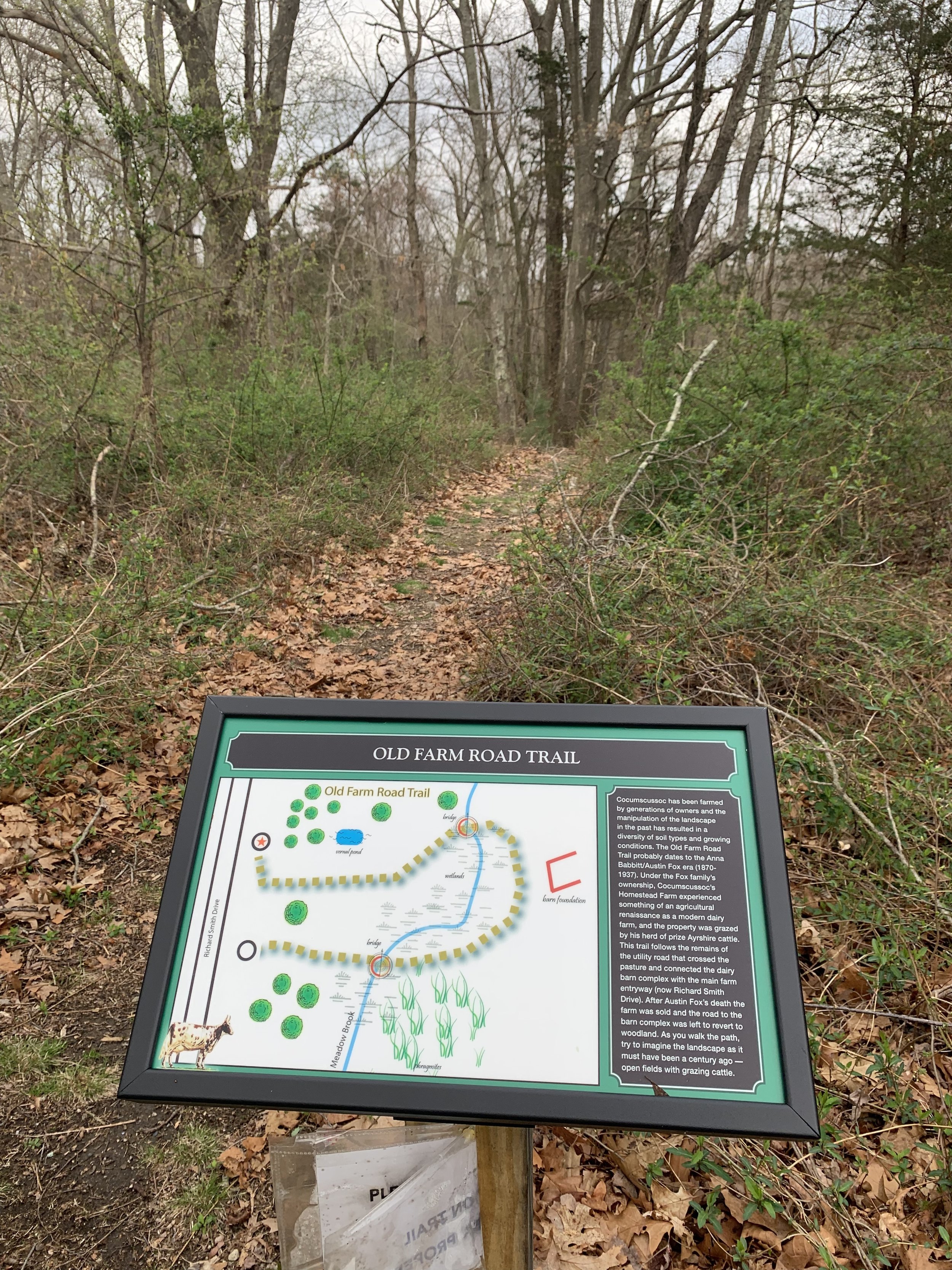
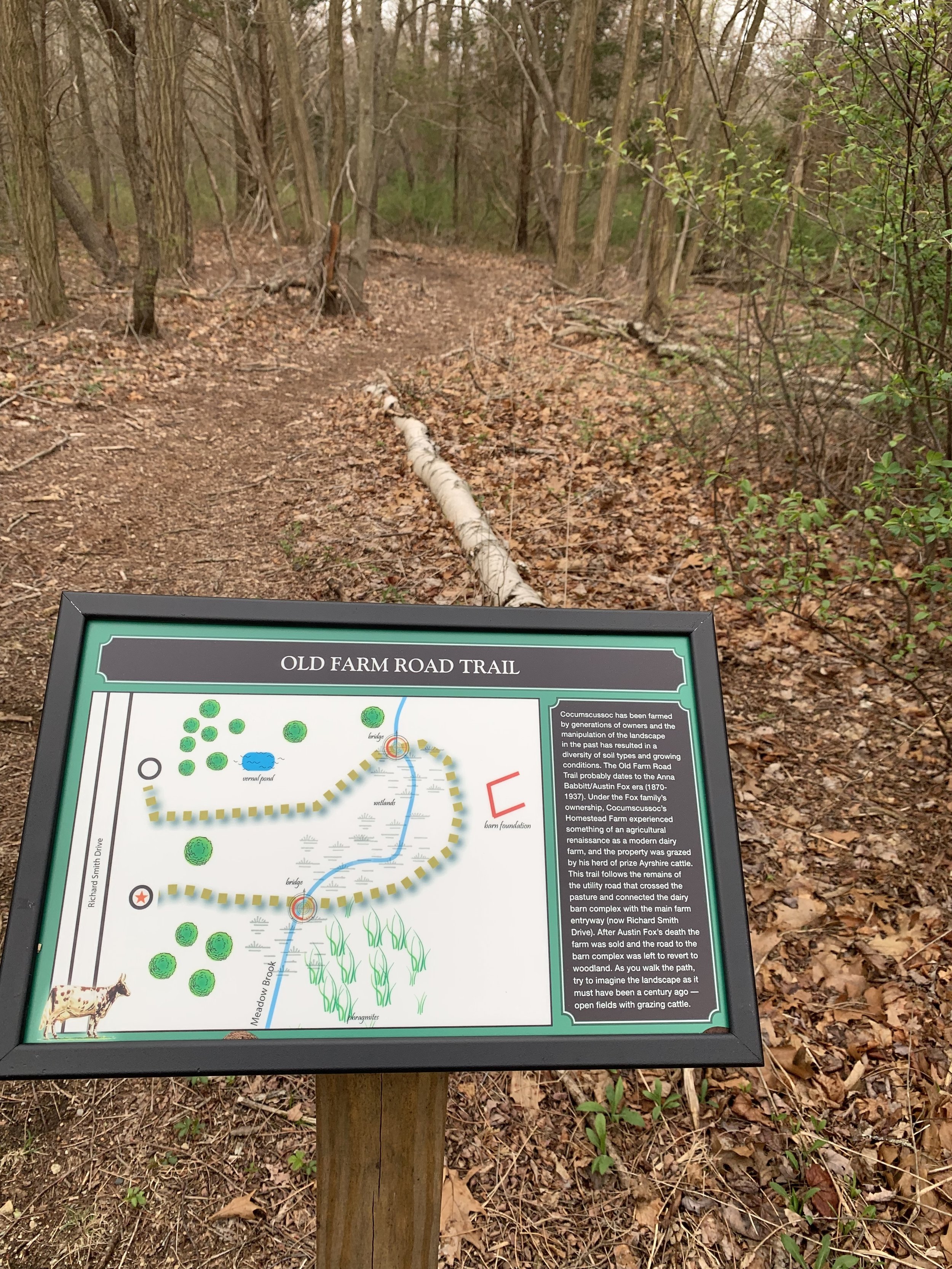
The Old Farm Road Trail
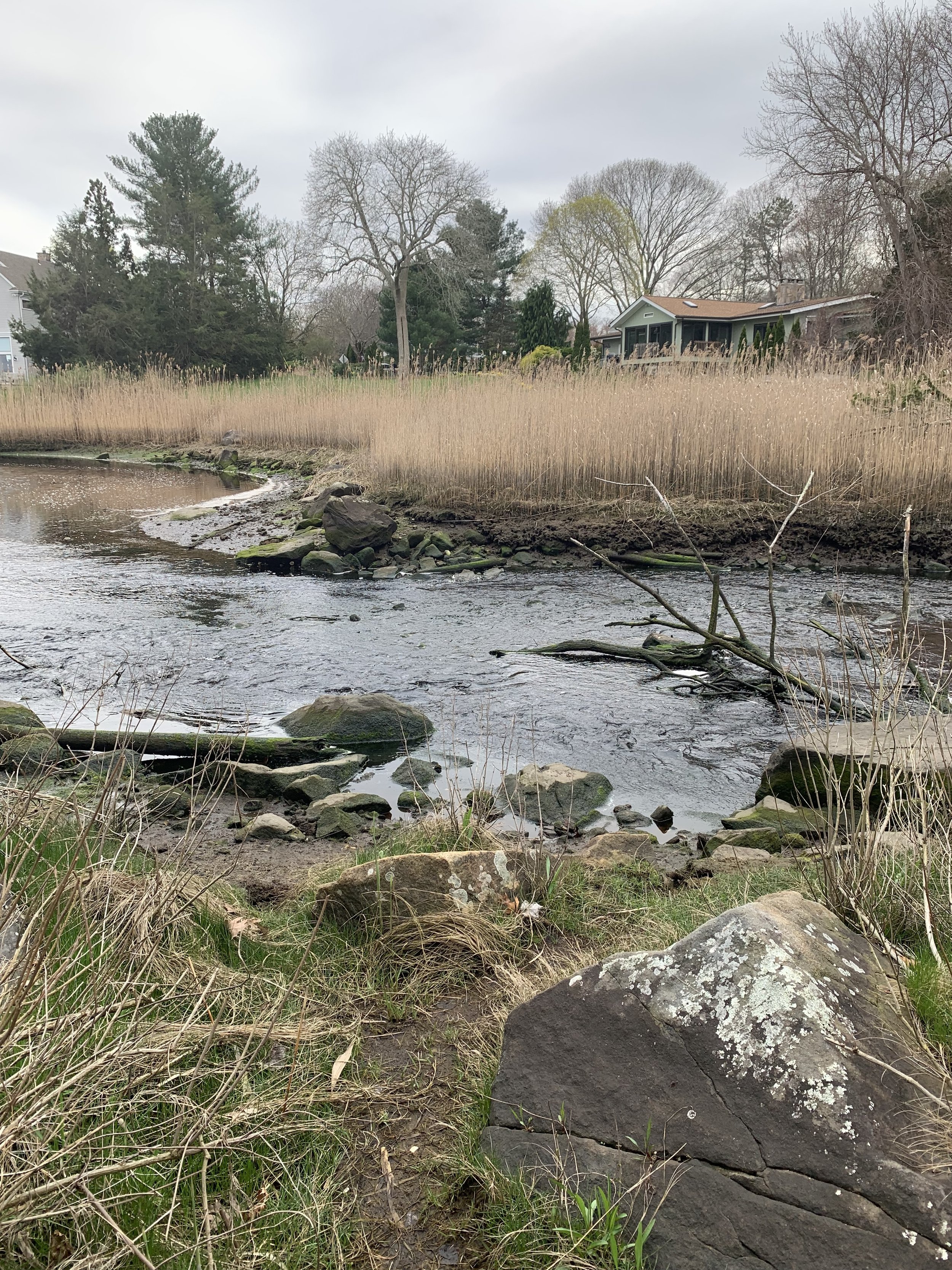
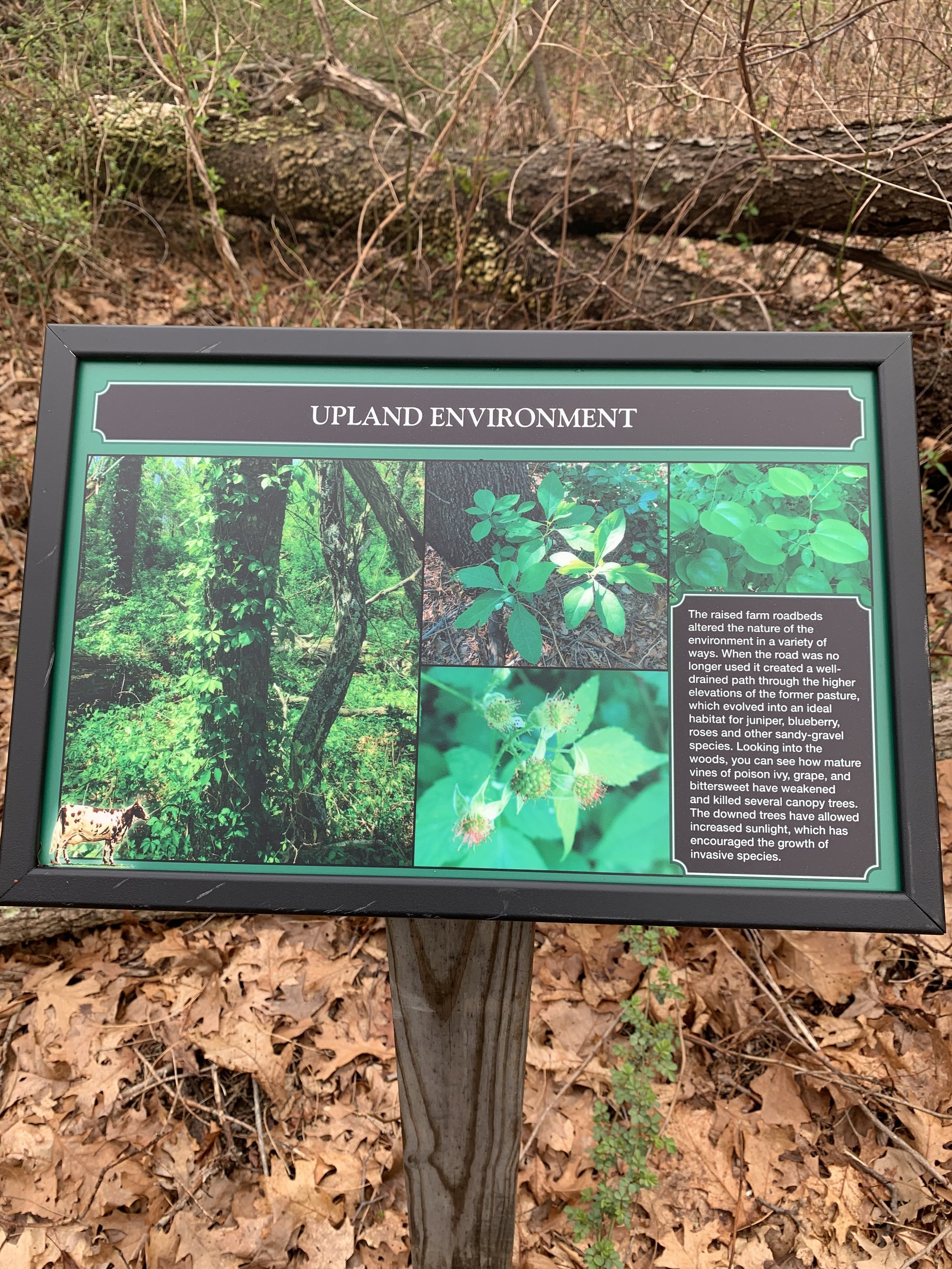
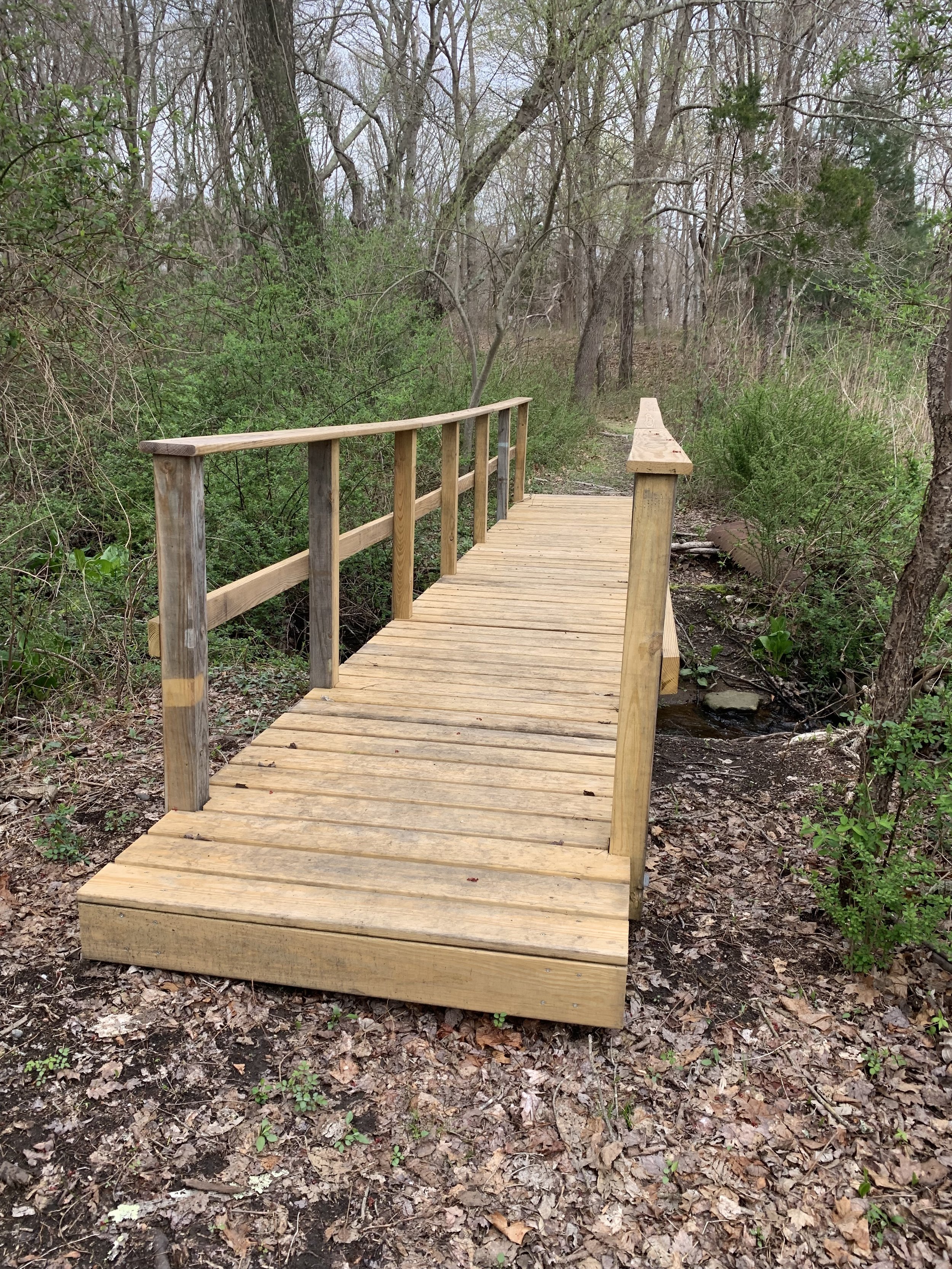
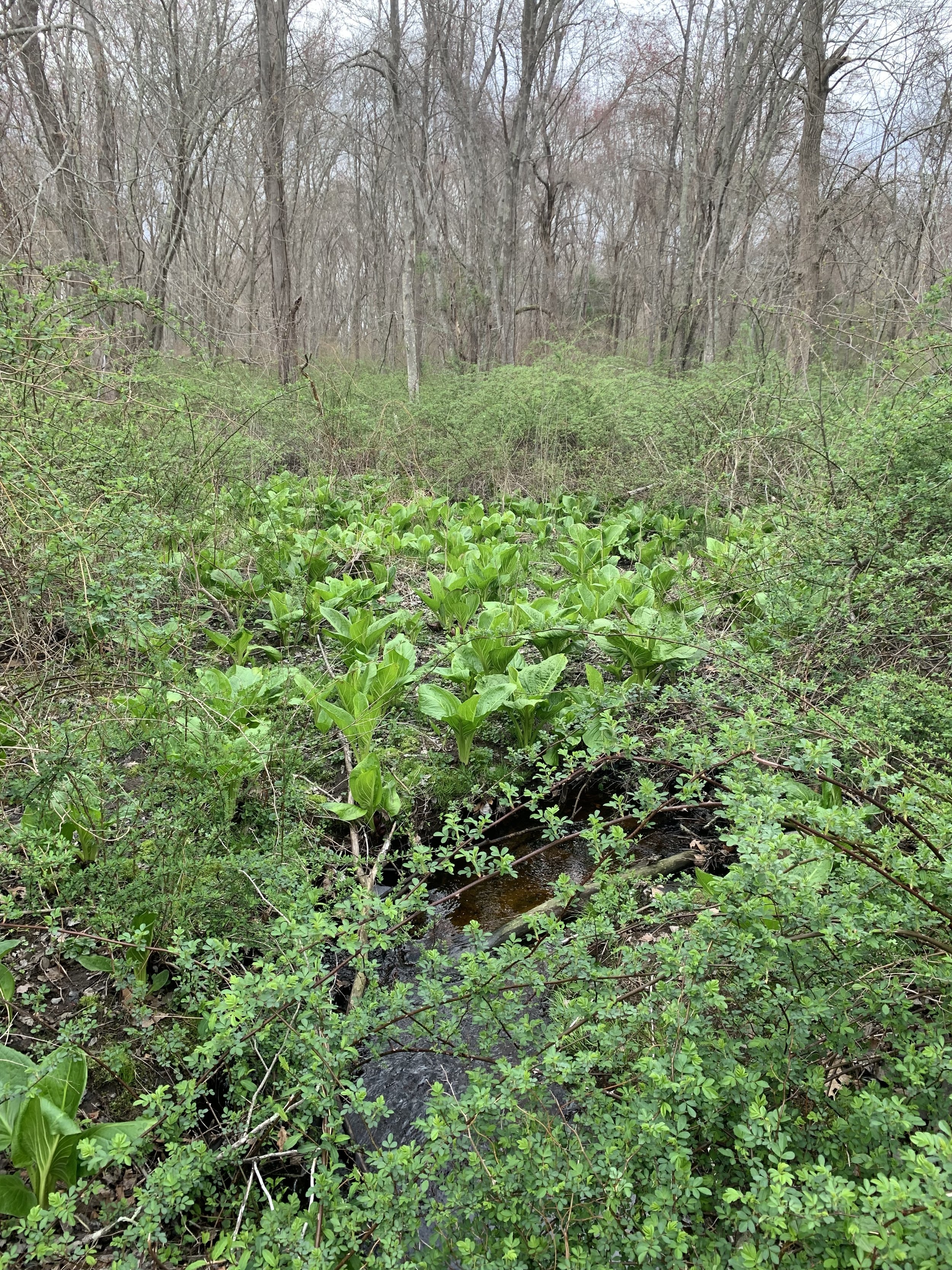
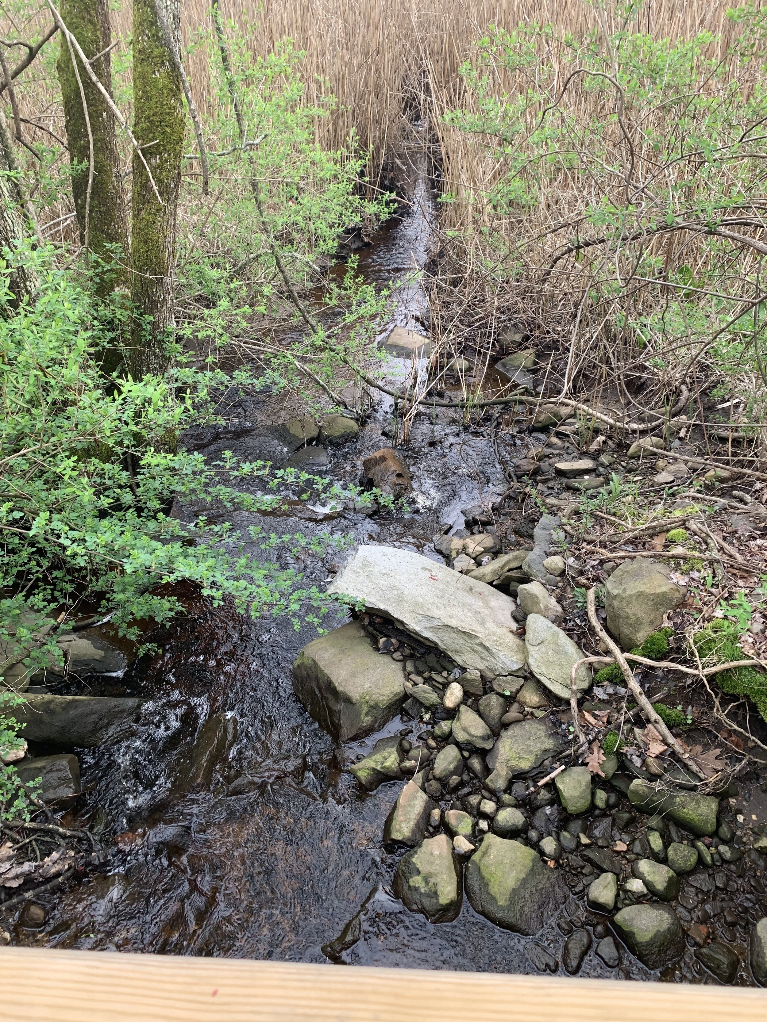
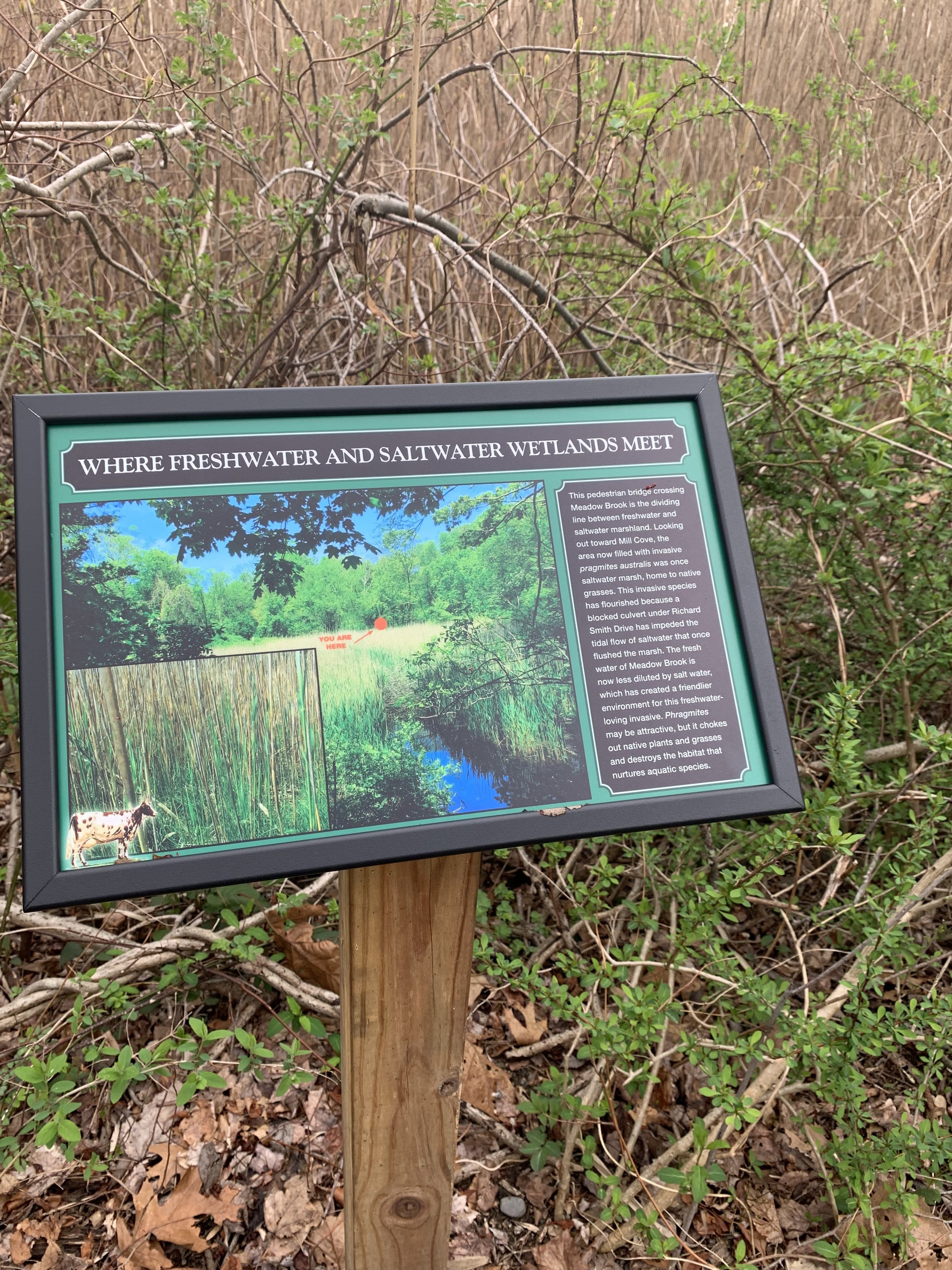
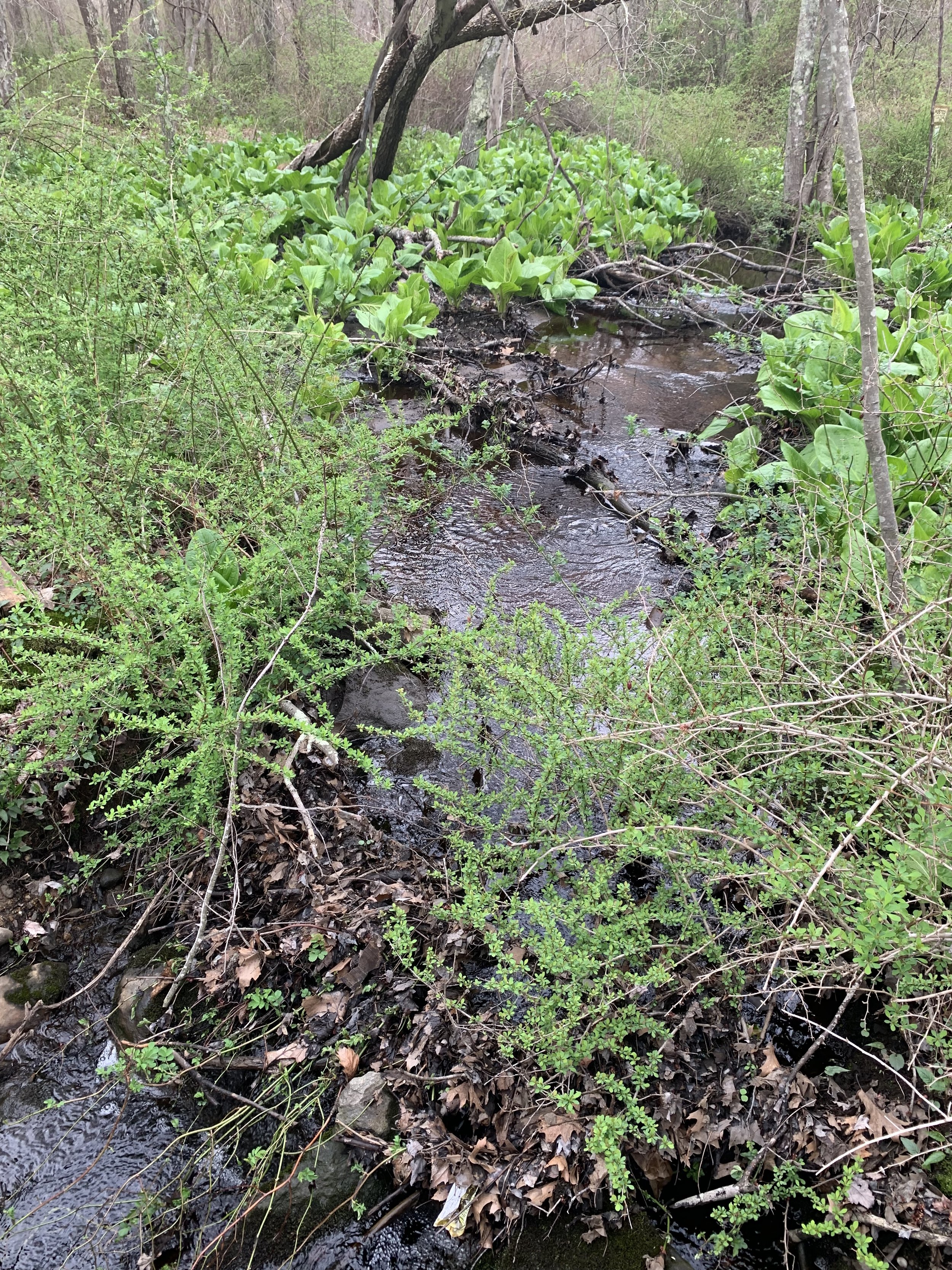
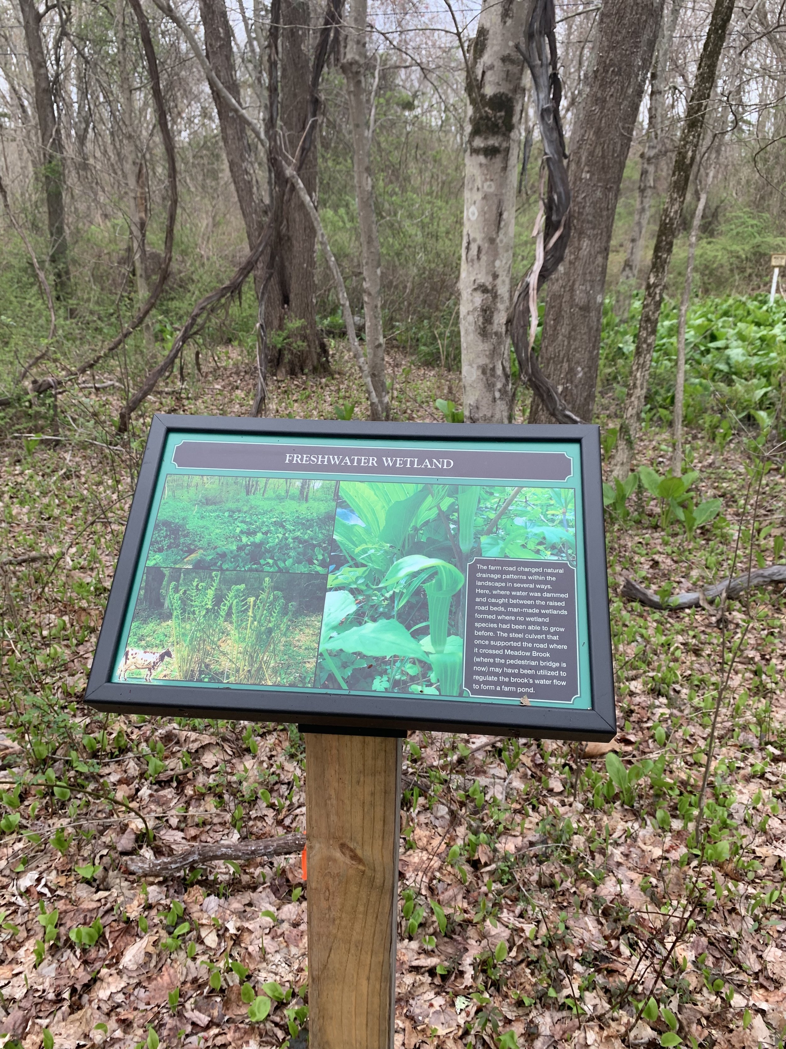
The Old Farm Road Trail follows the track of the farm roads that connected the Fox family’s Cocumscussoc Dairy barn complex with the main entry to the property. Along the trail can be seen remnants of what may have been a wall enclosing a large orchard (1802). A seasonal water feature and freshwater wetlands are the result of alterations in drainage patterns caused by the reconfiguration of Post Road and by the construction of the farm road and culverts that bridged Meadow Brook. Remnants of some of the dairy barn foundations can still be seen and, further along, a former salt marsh now clogged by invasive Phragmites australis.

The Sea View Railroad Path
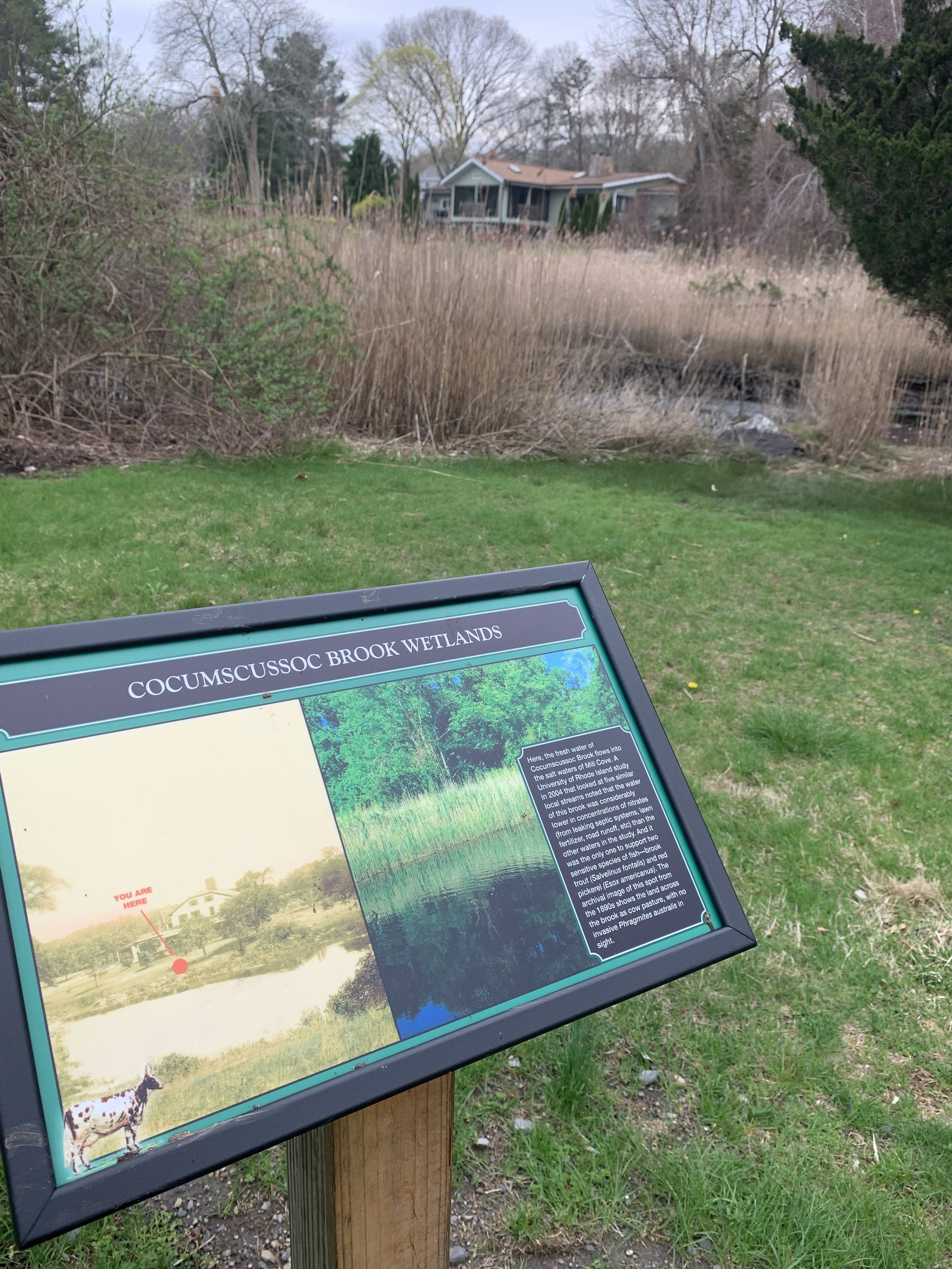
The Sea View Railroad (1899-1922) brought vacationers from Providence to East Greenwich, Wickford, Narragansett, and Wakefield. Construction of the roadbed changed the configuration of Post Road as well as the topography of the landscape along the roadside. The course of Cocumscussoc Brook was altered, and the sharp right-angled path of the stream has caused water to begin to undercut the old railroad bed. Changed surface and groundwater flow patterns resulting from this construction may have altered the nature of the landscape in other ways. Much of the freshwater wetland you see looking out toward Mill Cove was once upland pasture.
What’s Growing at Cocumscussoc?
Native trees and plants compete for space at Cocumscussoc with several invasive species. Invasive species*, the “bullies” of the plant world, are a problem because they overwhelm other plants in their vicinity to create their own monoculture. While walking the trails and paths at Cocumscussoc, keep an eye out for these plants and trees. Where are they growing?
Canopy
Red Oak (Quercus rubra)
Red Maple (Acer rubrum)
Sassafras (Sassafras albidum)
Eastern Red Cedar (Juniperus virginiana)
*Norway Maple (Acer platanoides)
Understory
High-bush Blueberry (Vaccinium corymbosum)
Winterberry (Ilex verticillata)
Summersweet (Clethra alnifolia)
Common Blackberry (Rubus allegheniensis)
Black Raspberry (Rubus occidentalis)
*Japanese Barberry (Berberis thunbergii and B. vulgaris)
*Honeysuckle (Lonicera morrowii)
*Multiflora Rose (Rosa multiflora)
*Bittersweet (Celastrus orbiculatus)
*Privet (Ligustrum sp.)
*Burning Bush (Euonymus alata)
*Poison Ivy (Toxicodendron radicans)
Native, but highly invasive and toxic
Virginia Creeper(Parthocissus quinquefolia)
Grape (Vitus riparia)
Roundleaf Greenbriar (Smilax roundifolia)
Wetland Areas
*Phragmites (Phragmites australis)
Skunk Cabbage (Symplocarpus foetidus)
Jack-in-the-pulpit (Arisaema triphyllum)
Jewelweed (Impatiens pallida)
Fern species